The projects that GeodataWIZ offers are focused on using geospatial data to better understand and analyse the archaeological and near-surface environment. By providing customized data solutions and project management services, GeodataWIZ can help clients in a range of fields to achieve their goals more efficiently and effectively. The selection below provides examples of recently completed projects.
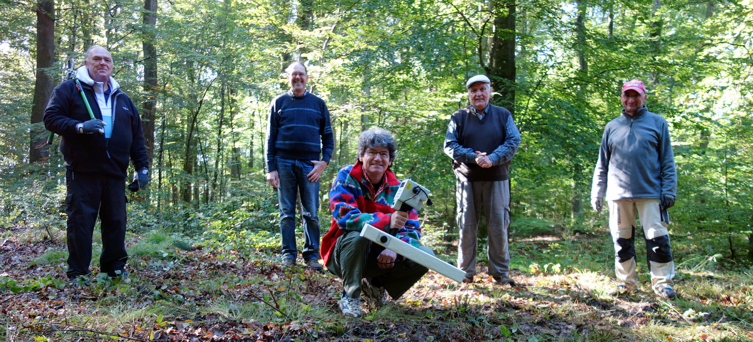
Magnetometer surveys in wooded areas
Although densely wooded areas can offer protection to subsurface archaeological features, conducting geophysical surveys with a magnetometer in such areas can be challenging. To address this issue, a group of local volunteers collaborated on a project to systematically compare different survey strategies for an Iron Age enclosure in Germany. Based on the results, an efficient investigation protocol was developed.
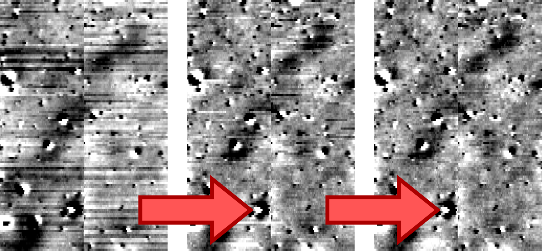
Rectifying data errors
During a client’s extended survey campaing a magnetometer sensor began producing sudden data jumps of approximately 0.5 nT, which significantly impacted the overall results. To address this issue, GeodataWIZ developed a specialized algorithm that can identify these jumps and re-level the affected data, resulting in a considerable improvement of data quality.
Multi-year survey of a Roman city
GeodataWIZ was responsible for project management during a multi-year geophysical investigation of a Roman city. After consulting with the client and conducting initial test measurements, a long-term survey strategy was developed. Detailed survey briefs were created to meet EAC standards, resulting in a fair tendering process for contractors and ensuring that the required data quality was achieved. Subsequently, the results were presented jointly at international conferences.
Geophysical Surveys
GeodataWIZ can conduct geophysical surveys to collect data about subsurface structures in a particular area. This might involve using techniques such as magnetometer or earth resistance surveys, or ground-penetrating radar investigations to identify buried features or anomalies that could be of archaeological interest. Using prior magnetic susceptibility measurements helps to evaluate the potential of magnetometer surveys. Having worked extensively in this field, Armin Schmidt has gained a deep understanding of how to achieve successful outcomes, even under difficult conditions. Paramount is the holistic approch that starts with detailed discussions with the client, desiging appropriate survey strategies, careful data collection, processing, analysis and interpretation and ending with the delivery of a detailed report and GIS-ready vector and raster data.
Overall, GeodataWIZ provides a range of services that can help clients in the archaeological and near-surface fields to understand better the geospatial data related to their projects.